Making the difference under and above water
Published on: 22/05/2025
As a leading specialist in maritime solutions, DISA International contributes to the most diverse projects in the exciting nautical world. We take a look at some interesting projects where DISA and its sister companies BlueTack and Skeye are making a difference, such as the new Cruquius Bridge, the salvage of the ro/ro ferry TAPORO VII and (drone) surveys along the coastline.
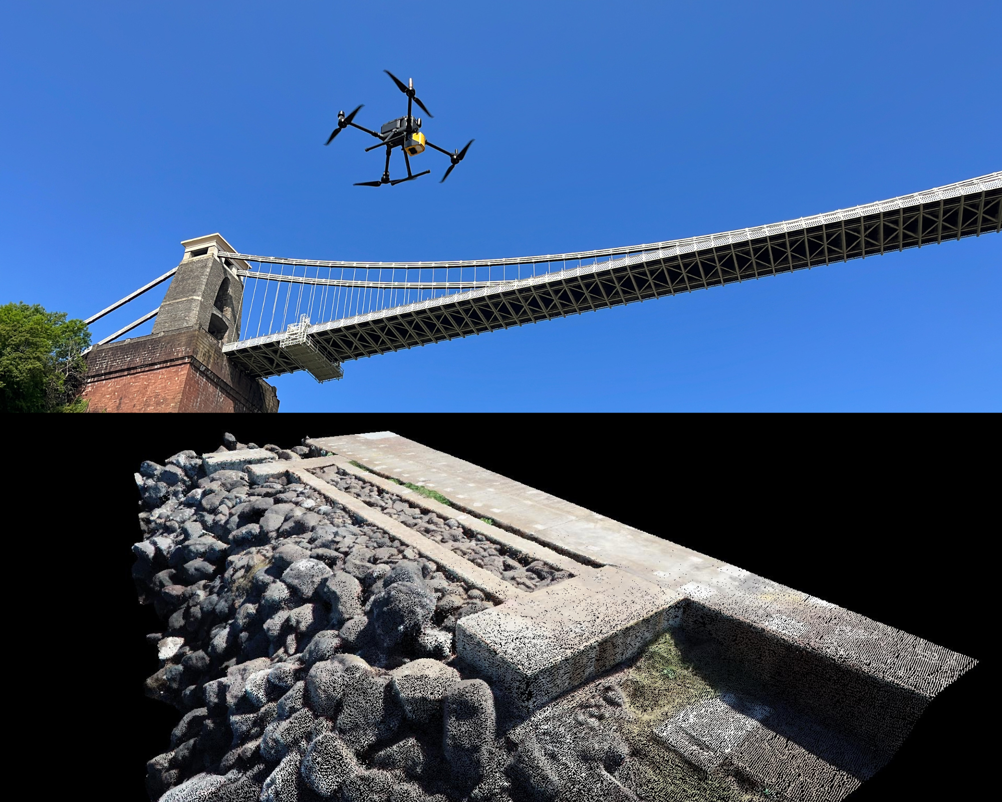
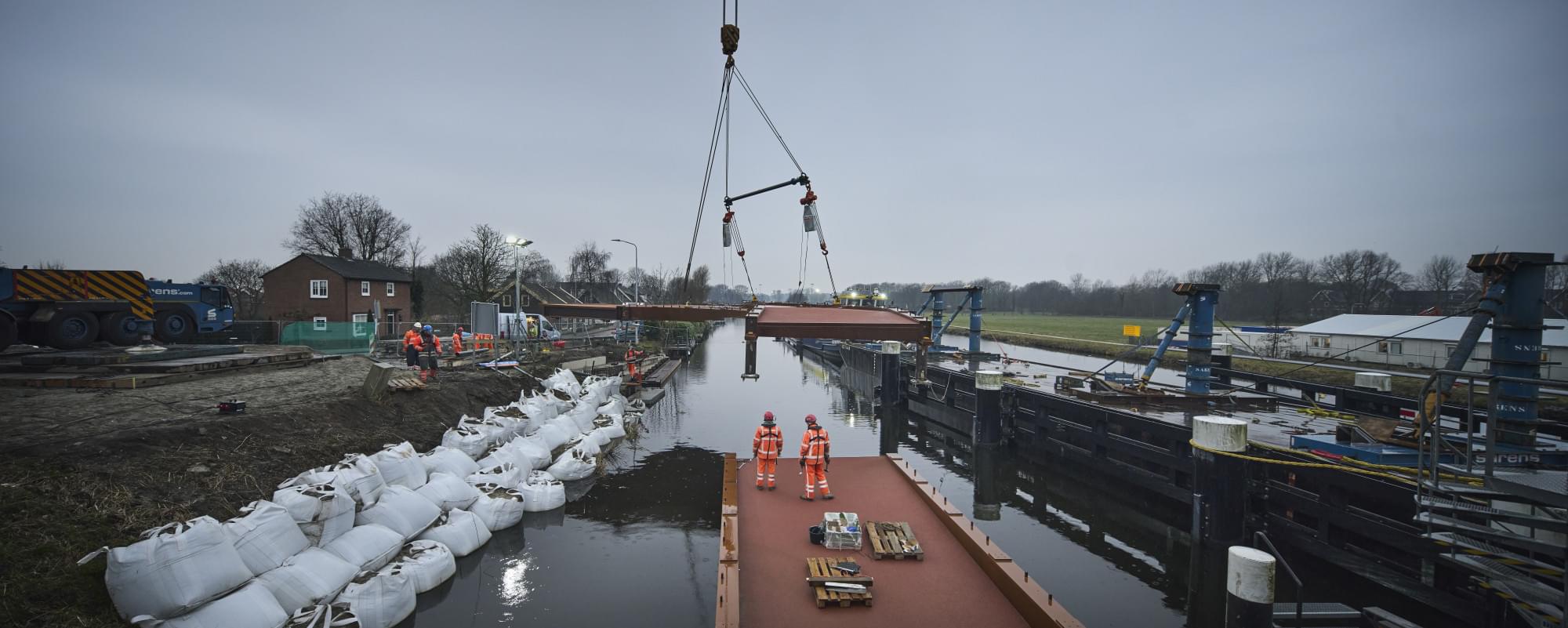
For the construction of the new Cruquius Bridge, DISA was commissioned to carry out the diving work required to connect the prefabricated bridge sections to the piers already installed. ‘In close cooperation with client Hollandia Infra, the optimal construction was devised to be able to perform high-quality welded joints underwater,’ says DISA's Marc Dröge. ‘The collaboration and thorough preparation ensured that the work could be carried out well within budget and schedule.’
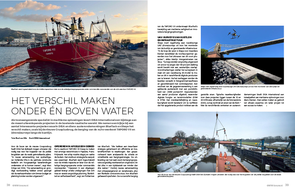
Ro/ro ferry TAPORO VII suffered severe water intrusion in Papeete, French Polynesia. The vessel heeled and hit the bottom. A quick and strategic approach was essential. BlueTack was engaged for the initial inspection and later for the full salvage operation under commercial conditions. ‘Operating in a remote area presents unique challenges and requires careful planning, flexibility and self-reliance,’ says Jan Polderman of BlueTack. "We adopted a two-phase strategy to ensure efficiency and cost-effectiveness. A specialised team analysed the damage and developed a salvage strategy. After expanding the team, the salvage operation was carefully prepared and executed. And all in a time frame of less than three weeks." Close cooperation with ship owners and insurers, plus a flexible contract structure, enabled BlueTack to scale up in phases. The successful salvage of the TAPORO VII underlines BlueTack's commitment to maritime safety and innovative salvage solutions.
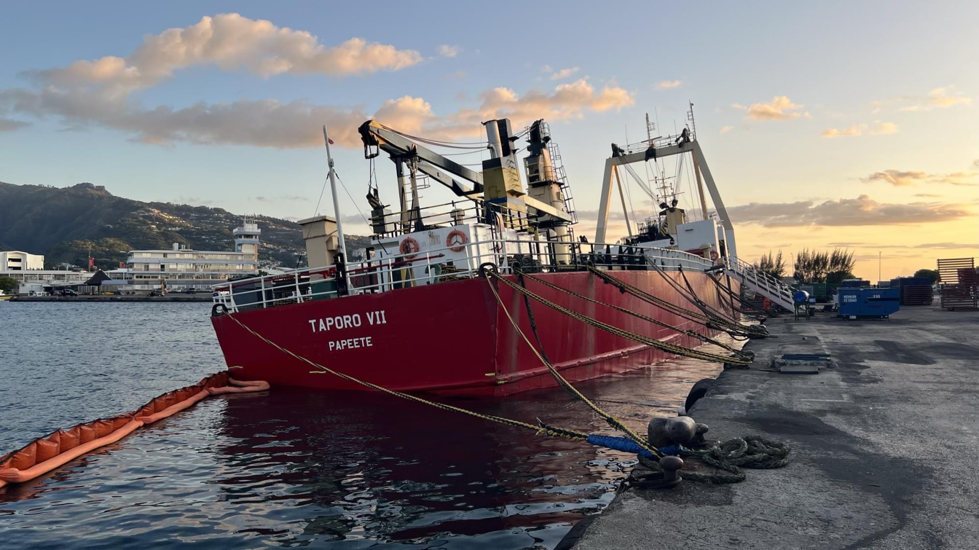
UAV SURVEYS OF COASTLINE AND INFRASTRUCTURE
Skeye regularly conducts highly accurate UAV (drone) surveys for monitoring coastline and related infrastructure. ‘Over the years, Skeye has become the partner of choice for several clients worldwide to carry out these types of projects,’ says Skeye's Martijn Hoogenstraaten. "Surveys are carefully conducted to ensure 100 per cent coverage is achieved with significant overlap.
Ground markings enable the survey team to create an accurate 3D model and deliver it in various digital products. After capture, the images are processed in photogrammetry software and combined with control points. A result of the data processing is a coloured point cloud with a point density of >5000 points/m². From this, a number of products are derived, including digital elevation and terrain models (DSM & DTM). A standard deviation and accuracy is calculated to verify that the delivered product meets the specified requirements. Typical accuracies for these projects are between 10 and 30 millimetres, depending on photo resolution (GSD), survey technique and customer requirements."
With its various entities and sister companies, DISA International offers a total package of maritime solutions for its customers. Not infrequently, they use each other's expertise to make each project a success.